Crustal Deformation Lab.
Gravity Member
Activities
Instruments
Gravity Member
| Name | Title | Internal Phone | Cell Phone | |
|---|---|---|---|---|
| Ashraf El-Kutb Mousa | Prof. Dr. | 1347 | +201061087313 | ashrafmousa07@gmail.com |
| Ali Mohamed Radwan | Prof. Dr. | 1294 | +201002435750 | amradwaneg@yahoo.com |
| Abdel-Monem Sayed Mohamed | Prof. | 1354 | +201147200199 +201003328781 | abdel_monem@yahoo.com abdelmoem@nriag.sci.eg |
| Salah Mahmoud | Prof. Dr. | 1355 | +201006548875 | salahm55@yahoo.com salahm@nriag.sci.eg |
| Hassan Ahmed Khalil Salem | Prof. Dr. | 1289 | +201017548771 | khalil_hassanahmed@tahoo.com |
| Nadia M. H. AbouAly | Prof. Dr. | 1293 | +201122619638 | dr.nadia_aboaly_2010@yahoo.com |
| Mohamed Abdel-Fadeel M. R. | Researcher | 1294 | +201205762295 | m2000_rashwan@yahoo.com |
| Mohamed Saleh A. M. | Researcher | +201013775482 | mohamed_sama26@yahoo.com | |
| Mahmoud Gomaa Ibrahim Hassan | Researcher | +201095100039 | mahgebaly1981@yahoo.com | |
| Mohamed Ali Abdelfattah M. D. | Researcher Assistant | 1374 | +201149328553 | mohamed10_1986@yahoo.com |
| Esraa Emam Abd El Salam H. | Researcher Assistant | 1293 | +201061524235 | esraa_emam99@yahoo.com |
| Ahmed Saad Zaki | Researcher Assistant | 1374 | +201010871799 | geo.ahmed_saad@yahoo.com |
| Abdel Hamid Mohmed Abdel Rahman | Researcher Assistant | 1374 | +201012914440 | mido_20103720@yahoo.com |
| Hanan Genidi | Researcher Assistant | 1293 | +2 | hanangenidi@nriag.sci.eg |
| Ahmed Elhadi Sherif | Researcher Assistant | 1374 | +201010833983 | ahmed.sherif@nriag.sci.eg |
| Mohamed Alsaid Mahrous | Researcher Assistant | 1374 | +2 | mohamedmahrous@nriag.sci.eg |
| Alshimaa Yousry H. A. | Assistant Researcher | 1293 | alshimaayousre@gmail.com | |
| Mahmoud Etman | Assistant Researcher | 1374 | +201004037813 | mahmoudetman205@gmail.com |
Activities
The activities of our lab are summarized in the following fields:
Laser scanner surveying
Laser scanning (LS) is a surveying technique used for mapping topography, vegetation, urban areas, ice, infrastructure, and other targets of interest. Where the precise position and orientation of the sensor is known, and therefore the position (x, y, z) of the reflecting objects can be determined. There is an increasing interest in Terrestrial Laser Scanning (TLS), where the laser scanner is mounted on a tripod or even on a moving platform, i.e. Mobile Laser Scanning (MLS). LS is sometimes referred to as LIDAR because of its central role. The basic principle of LS is to use a laser to illuminate an object and a photodiode to register the backscatter radiation and to measure the range. The output of the laser scanner is then a georeferenced point cloud of LIDAR measurements, including the intensity and possibly waveform information of the returned light.
Recently, in NRIAG two type of LS were applied, those are MLS and TLS. It were applied in documentation of some archaeological and vial areas such as Ahmed Hamdy Tunnel, Saqqara step pyramid and El Lahun pyramid. .
Geodetic networks in Egypt
In 2006, NRIAG started the establishment of the EPGN. Basically, the site selection was aimed to cover geographically all the Egyptian territory but also considering the tectonic setting of Egypt. NRIAG started with 6 permanent stations and nowadays the number has reached to 25 stations.
Instruments
Devices owned by
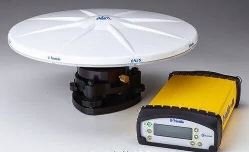
GNSS Laboratory Instruments
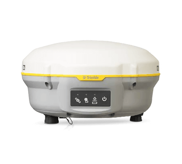 Trimble R8s GNSS Receiver
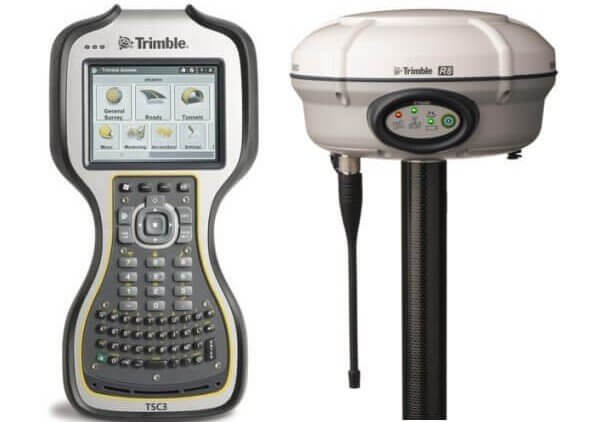 Trimble R8 GNSS Receiver
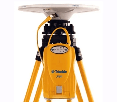 Trimble 5700 GNSS Receiver
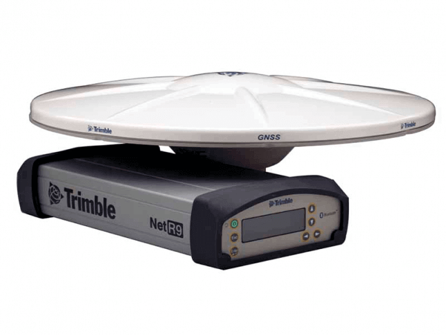 Trimble NetR9 GNSS Receiver
 Trimble NetR5 GNSS Receiver
Laser Scanning Instruments
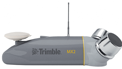 Trimble MX2 Mobile Mapping
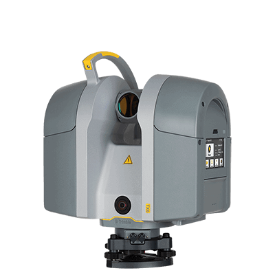 Trimble TX6
Optical Instruments
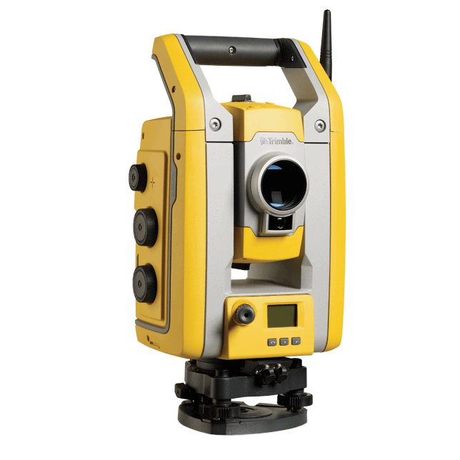 Trimbe S5 total Station
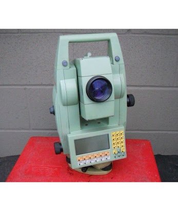 Leica TC1100 Total Station’
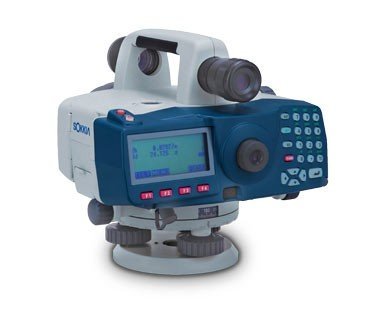 Sokkia SDL1 Didital Level