Gravity Lab.
| Name | ٍTitle | Internal Phone | Cell Phone | |
|---|---|---|---|---|
Salah Saleh | Prof. Dr. | 1289 | +201099343582 | salahsmm@yahoo.com |
Khaled Zahran | Prof. Dr. | 1356 | +20100 560 7585 | zahran@nriag.sci.eg |
Elsayed Abdelazim Issawy | Prof. Dr. | 1356 | +201005241812 | issawy@yahoo.com |
Basem Elsaka | Prof. Dr. | basem_elsaka2002@yahoo.com | ||
Karem Fathy | Doctor | 1374 | +201220997609 | karemphysic@yahoo.com |
Mohamed Sobh Emam | Doctor | 1374 | +201063027082 | mohamedsobh35@yahoo.com |
Soha Reda Hassan | Doctor | 1293 | +201019644333 | soha1987_reda@yahoo.com |
Mostafa A. M. Elwan | Doctor | 1374 | +201019889710 | mostafaelwan40@yahoo.com |
Moataz S. A. Ibrahim | Assistant Researcher | 1374 | +201119907628 | geomoataz2012@yahoo.com |
Hesham El haddad | Researcher Assistant | 1374 | +201210329331 | heshamsabry@nriag.sci.eg |
| Ahmed Elgarhy | Assistant Researcher | 1374 | +201022844553 | eng.ahmedelgarhy@yahoo.com |
| Mohamed Hussien | Assistant Researcher | 1374 | +201098262333 | mohamedhussien@yahoo.com |
The activities of our lab are summarized in the following fields:
– Detailed gravity survey for the purposes of Bouguer anomaly maps establishment, Geoid undulations, delineating subsurface geologic structures for Petroleum, mineral, geothermal, underground water exploration as well as seismology, lithosphere and Basement relief studies.
– First order gravity Base station establishments.
– Microgravity measurements for Archaeology, site selections, Caves detections, on-site inspection (OSI) (CTBTO) and other engineering problems.
– 4D gravity measurements for geodynamics and crustal movements studies by monitoring the temporal density variations around the seismic-active zones and faults.
– Monitoring of different kind of reservoirs using 4D gravity studies like geothermal and underground water.
– Continuous gravity measurements in order to study Earth elasticity, Earth tides, frequent instrument calibration for the other relative gravimeters.
– Tide gauges measurements and satellite altimetry observations for different locations in Egypt in order to monitor sea level rising, Delta sinking as well as inland water monitoring.
– Different applications of Satellite Gravimetry (Regional structure geology, temporal gravity variations, water mass changes, ….etc.
Some Applications of Gravity Method
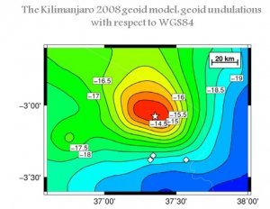
Geoid
The determination of the geoid has been one of the prime goals of geodesy. Knowledge of geoid undulations with respect to some reference surface was needed for the determination of the figure of the earth, for the precise reduction of distance measurements to a reference ellipsoid, and for the determination of the geocentric location of points on the surface of the earth. Currently and in the future, undulation information can also be used in geophysical studies related to crustal structures and in oceanographic studies related to sea surface topography. The actual determination of global geoids has been carried out by using gravimetric data, satellite‐derived information related to the gravitational field of the earth, or a combination of the two techniques. Regional geoid determinations have been made by astro-geodetic techniques. For some applications of undulation information, undulation standard deviations of the order of ±5 m would be sufficient (Rapp, 1974). Such accuracy can be obtained by using data currently available. In the past few years, renewed interest in the geoid arose when the concept of satellite altimetry was proposed to measure the distance from the satellite to some area on the ocean surface.

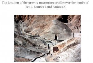
Archaeology
Our Gravity lab is the pioneer in the field of archeo-geophysical prospecting in our institute and in Egypt too. The archeo-geophysicl prospecting started in our lab in 1997 by studying the applicability of the micro-gravity investigations in archaeo-prospecting and detecting some known and unknown hidden features in the Valley of the Kings as well as the tomb of Nefertari, Valley of Queens, Luxor, Egypt. These studies were followed later by many research papers and scientific research projects.
Crustal deformation and Geodynamics
Temporal gravity variations approved an important method for detecting the vertical movement of recent crustal deformation. The ongoing gravity and GPS observations can monitor the crustal movements by detecting the vertical component of recent crustal movement and mass redistribution. The correlation between temporal gravity variations have not direct relation to Earthquake activities but if the variations of gravity field are inhomogeneous in the space-time distribution it cloud reflect clearly the development and occurrence of earthquake. The co-seismic and post-seismic signature of the seismic events on temporal gravity variations nowadays are widely monitored by GRACE Satellite Gravimetry. The geodynamic studies and recent crustal deformation using temporal gravity variations by our lab were early started in 1994 in Aswan region. But only in 1997 was a new epoch of long-term investigation initiated. The temporal non-tidal changes of gravity exceed the level of confidence significantly. The changes were compared with older available geodetic data. The successful campaigns of gravity measurements for local and regional geodetic networks around the High dam are annually performing. Other two gravity networks were later established and measured periodically as the network around Greater Cairo and Sinai.In additions, the temporal gravity variations are using to monitor the different kind of reservoirs like geothermal and underground water basins.
Geotechnical & Civil Engineering
Gravity can detect Voids or Cavities whether they are tunnels washouts or sinkholes, also can be used to study the integrity of roads, dams, and dikes, looking for areas of weakness in the sub-surface
Moho depths and lithosphere modelling
The use of a seismic velocity measurement as the only indication of rock density does not provide a useful constraint when attempting to reproduce observed gravity variations. An appropriate model for isostatic compensation is probably the most important factor for successful predictions of crustal structure on the basis of gravity data P.J. Barton (1986). The lithosphere is the outermost, relatively rigid shell of the Earth, made up of the crust and the underlying lithospheric mantle. Gravity gradients of the GOCE (Gravity field and steady state Ocean Circulation Explorer) mission are available and provide free available data with global homogeneous coverage. The spatial resolution is about 80 km which makes it possible to construct regional models of large or remote areas. Gravity gradient data are sensitive to geometry and density variations of the main lithospheric layers, i.e. sediment thickness, the Moho depth and the temperature and composition of the upper mantle. The measured “free air” gravity gradients still include the effect of topographic masses. The topography causes the strongest gravity gradient effect and has to be subtracted to unravel the lithospheric signal. Examples of Moho depth (Seismically-constrained gravity inversion) and Lithospheric Modelling are performed by our lab.
Oil & Gas Exploration:
Gravity can be used to determine the location of a Salt dome in which oil or gas could be present. Measuring the density change in an oil reservoir can assist in the oil and gas recovery process. It’s also used to determine Subsurface Structures and Basement delineation.
Mineral Exploration
Gravity can detect Volcanic Massive Sulphides deposits associated with nickel deposits, diamond bearing Kimberlites, Banded Iron Formations, and Impact Basins. Gravity can also be used to determine the size of the deposit.
Satellite Gravity data derived from GRACE and GOCE
Satellite Gravity data derived from GRACE and GOCE Used in the detection of global targets such as regional underground aquifers, source rock maturation, and Moho boundary delineation.
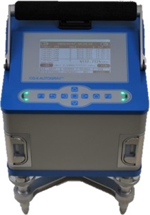
Devices owned by Gravity Laboratory and Soil Unit
Gravity Laboratory Instruments
Scintrex CG6
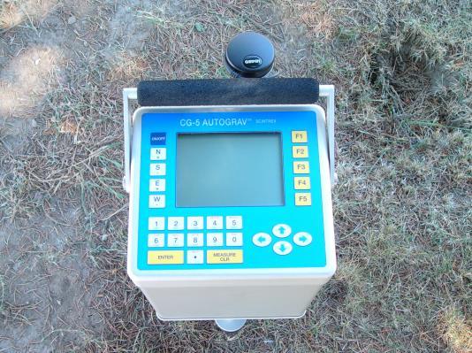
Scintrex CG5
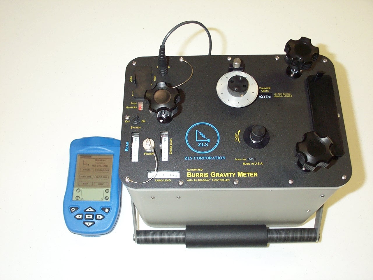
ZLS Gravimeter
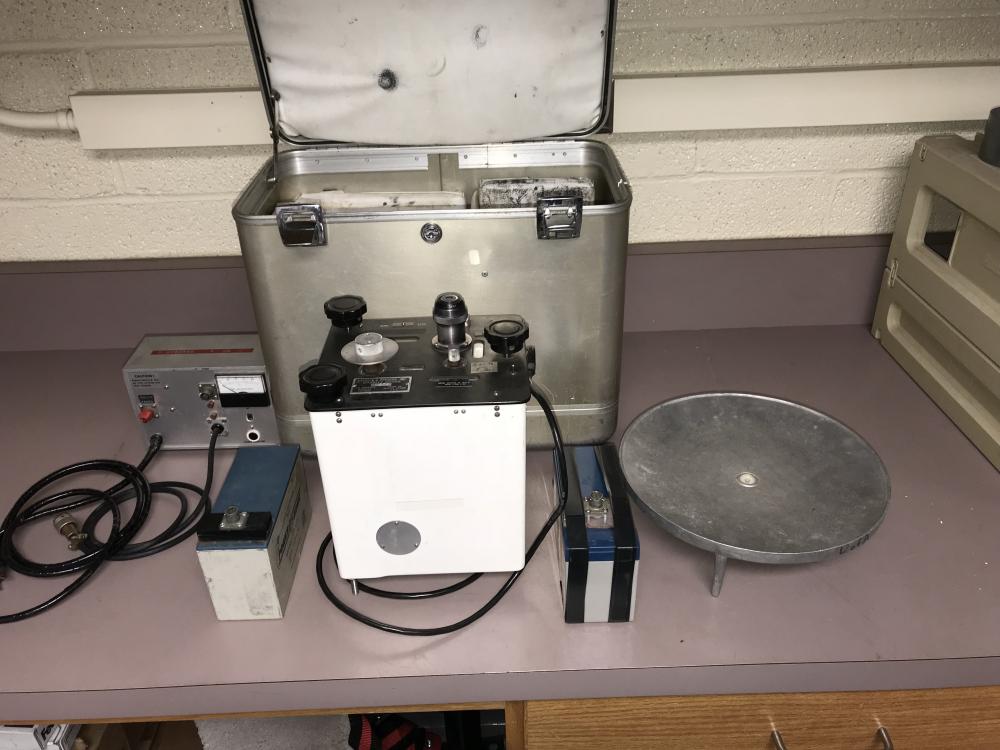
Lacoste & Romberg models G 1043
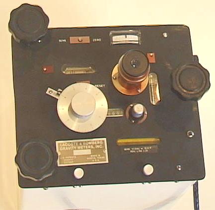
Lacoste & Romberg models D 218